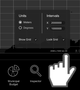
The Graticule tool is developed to allow users to have a grid overlayed over the map area. The user can configure the grid's horizontal and vertical intervals in either meters or degrees.
Step 1: Activate the Tool
- Hover over the 'Graticule' tool to activate it.
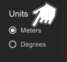
Step 2: Choose 'Units'
- Choose between 'Meters' and 'Degrees'.
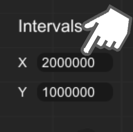
Step 3: Set Interval Values
- Set 'X' and 'Y' interval values.
Step 4: Show and Lock Grid
- Check the 'Show Grid' checkbox to show the grid.
- Check the 'Lock Grid' checkbox to lock the grid to the map view area.