Central frame with virtual map puts together spatially datasets activated in Data Layer Panel as well as spatial outcomes from Tool Panel. User can control map by:
¶ UI Features
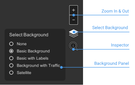
- Zoom In & Out Buttons can be used by clicking on (+) button to zoom in and on (-) button to zoom out
- Select Background gives users dialog with the list of available background
- Inspector change the cursor which allows user to get the value of data cell
- Scale gives the measurement of current zoom level
¶ Mouse Control
- Zoom of the map can be activated by scrolling on mouse
- Pam of the map can be activated by moving the mouse while the left button is pressed
- Rotate of the map can be activated by moving the mouse while the right button is pressed
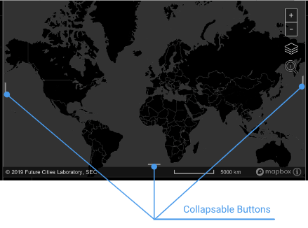
¶ Collapsible Button
Each panel has a line in the middle which allows to users collapse the whole panel so the central map can expand.
¶ Map Info
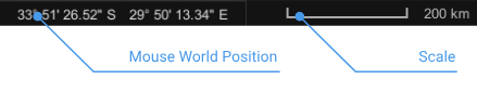
- Mouse World Position indicates position whore is currently cursor of the mouse as Longitude and Latitude
- Scale indicates the approximate length in the real world