¶ Municipal Budget
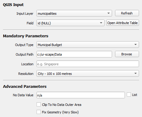
This section will describe how to import data for ur-scape's Municipal Budget tool.
It requires a vector GIS dataset needs to be selected from the Input Layer dropdown, and the appropriate Field. Then, the Output Type should be set to Municipal Budget.
For more information about the remaining parameters please visit
¶ Reachability
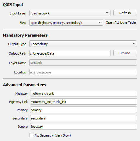
This section will describe how to import data for ur-scape's Reachability tool.
First, a vector GIS dataset needs to be selected from the Input Layer dropdown, and the appropriate Field. Then, the Output Type should be set to Reachability. Once this is done, a list of Road Network Classifications will appear in the Advanced Parameters section.
¶ Road Network Classifications
Road network data can have various different types, and these types can differ deppending on the data source. The Reachability tool in ur-scape uses a predefined list of Road Network Classifications which appear at the top of the Advanced Parameters. This list allows the user to map the Field values from the Input Layer onto ur-scape's predefined classifications. It comes initialised with the default values for OpenStreetMap (OSM) data.
- Highway: high speed roads such as expressways or motorways
- Highway Link: road segments that connect "Highways" to others
- Primary: primary roads
- Secondary: secondary roads
- Ignore: any road network segments that should be excluded
For more information about the remaining parameters please visit